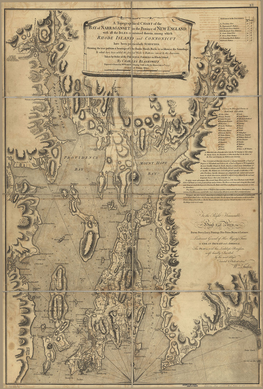
A Topographical Chart of the Bay of Narraganset in the Province of New England, 1777
Surveyed by Charles Blaskowitz, Published by William Faden, London
From the collection of the Library of Congress
Surveyed by Charles Blaskowitz, Published by William Faden, London
From the collection of the Library of Congress
|
This map of Narragansett Bay demonstrates how information can be recycled for different purposes. It was made using surveys taken for the British military between 1764 and 1775. This extensive survey was most likely performed to determine if the bay was an appropriate site for the British navy. Later, wealthy farmers from Aquidneck Island commissioned this map, which utilized the survey information.
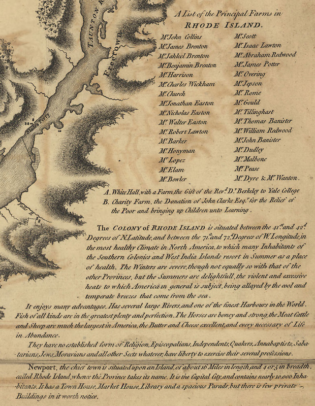
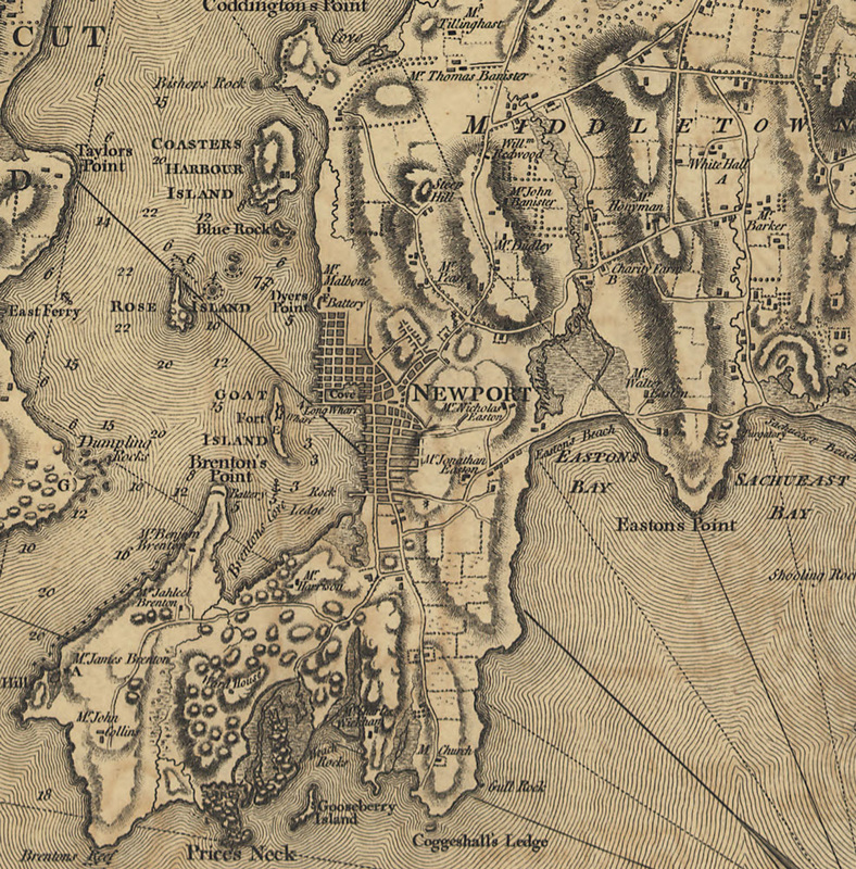
The map shows the topography of the bay islands and surrounding mainland, and includes detailed depictions of roads, forts, towns, hills, and the “Principal Farms,” including that of Abraham Redwood in Portsmouth. A close look at the map shows the relationship of land ownership to modern street and place names. The area labeled as Mr. Harrison’s land is now bisected by Harrison Avenue; Easton’s Beach and Bay are located between the lands of Walter Easton and Jonathan Easton, respectively. The island of Aquidneck is shown to be a controlled and fertile land, and the description on the map is delightful in its details about the area: “Fish of all kinds are in the greatest plenty and perfection. The horses are boney and strong, the Meat Cattle and Sheep are much the largest in America, the Butter and Cheese excellent, and every necessary of Life in Attendance,” but the cultural shortcomings are also mentioned: “It has a Town House, Market House, Library and a spacious Parade, but there is few private Buildings in it worth notice.” The pleasant summer weather, religious freedoms of the inhabitants, and geography of the area are also highlighted in the text. Although this map was produced for the agricultural leaders, it is interesting that it includes details useful for military purposes. There are notes near the locations of batteries and next to military features: “in this part of the Country there is a Furnace and an Iron Foundry where they cast cannons” and off Bristol: “Battery to Anoy ships attempting to pass up the river.” Soundings and detailed notations of rocks and other navigational obstacles are included as well. The purpose of including these details could have been to lend the map a sense of legitimacy but also could have spoken to commercial maritime accessibility and fortified safety of the port for trade. |
|
