Manuscript map of the city and harbor of Newport, August 9, 1758.
Ezra Stiles, Newport, RI
From the collection of the Redwood Library and Athenaeum
Ezra Stiles, Newport, RI
From the collection of the Redwood Library and Athenaeum
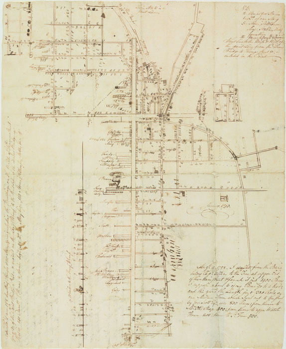
This map is particularly important as a personal record of the city of Newport for a number of reasons. It was created by a highly influential and interesting mapmaker, and it is a manuscript map (original ink on paper), not a print intended for widespread use.
Ezra Stiles made this map in 1758, when Newport was still part of the British Empire. During this time, Stiles was Pastor at the Second Congregational Church on Church Street, Librarian at the Redwood Library and Co-Founder of what was to become Brown University. When the war started, he left for New Hampshire and later became President of Yale College.
Ezra Stiles made this map in 1758, when Newport was still part of the British Empire. During this time, Stiles was Pastor at the Second Congregational Church on Church Street, Librarian at the Redwood Library and Co-Founder of what was to become Brown University. When the war started, he left for New Hampshire and later became President of Yale College.
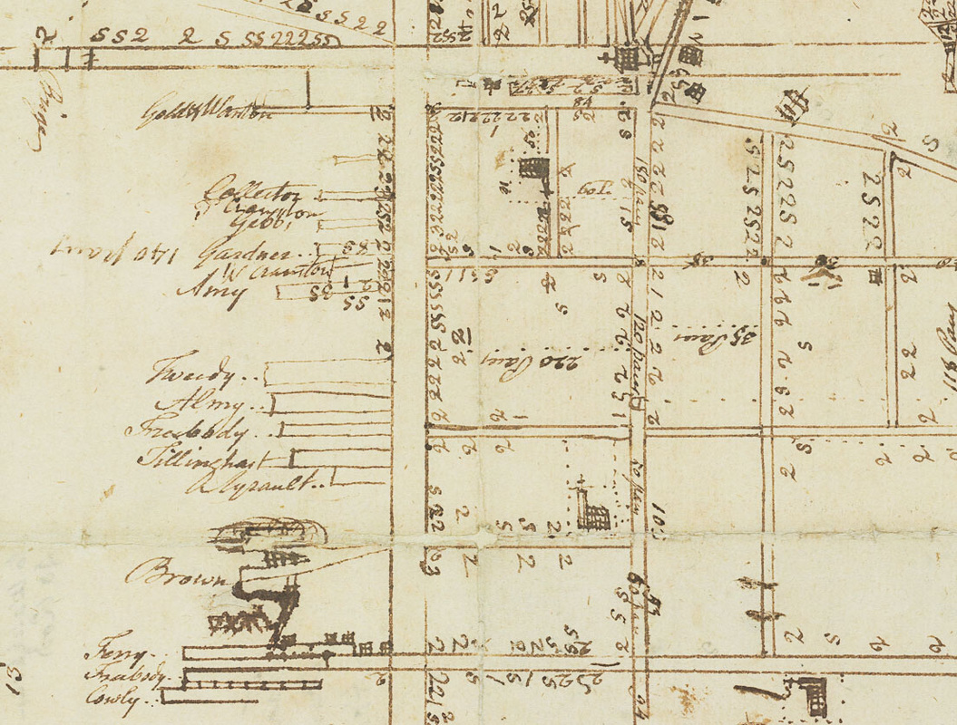
Detail of Newport harbor, note the names written beside each wharf
|
The map does not show building footprints, but does label many lots by their respective owners’ names. Many of the names he records are those of the most influential men in Newport: Redwood, Brown, Coggeshall, Malbone, and these are concentrated on the Southern or “Court End” of Thames Street, close to the wharves, industries based on mercantile trade, and, according to Stiles, many shops and businesses.
Properties are identified by an interesting system: a “1” for a one-story building, a “2” for a two story, an “S” for stores, stables, shops, etc., and a “2” with a line through it for a 2 chimney, 2 story house. This is explained in a key to the map, located in the upper right corner. From 1776-79 the British occupied Newport , and during this time many buildings were destroyed. As such, this is map is also a wonderful record of what Newport was like in this pre-war era after which the city had a long and slow recovery. |
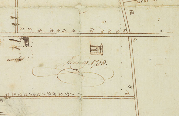
Detail showing Newport Tower
|
The map begins at the Point, with its recognizable Quaker grid pattern, extends west to what is now Bellevue, and down to what was then the southern end of Thames Street. Stiles’ measurements were taken by counting paces, as he notes in the lower right corner of the map in script: “Augst. [sic] 9 1758. I walkt [sic] from the Bars below Capt. Allens to the Tree at upper end of Main Street & found it just 1900 paces…” He notes some important buildings like the Colony House and Redwood Library, but the only decorative element is a little drawing of the Newport Tower in Touro Park. While the map is oriented with the North at the top, the tower is drawn as it would be viewed walking up the hill. In order to read the text on the left side of the map, the page must be rotated 90 degrees. Viewers get the feeling of the ambulatory nature of this interesting map, that it was produced from a number of first-hand experiences.
|
