The Newport Map Project
  • Home
  • Historic Maps
    • 1758 - Manuscript Map
    • 1777 - Plan of Newport
    • 1777 - Topographical Chart
    • 1780 - Plan of the Position of the French Army
    • 1838 - Newport Harbor
    • 1859 - City of Newport
    • 1876 - Atlas of Newport
    • 1878 - Birds-Eye-View
    • 1883 - Atlas of Newport
    • 1884 - Sanborn Map
    • 1893 - Atlas of Newport
    • 1907 - Atlas of Newport
    • 1913 - Proposed Improvements for Newport
    • 1921 - Atlas of Newport
    • 1933 - Newport's Famous 10 Mile Drive
    • 1954 - A Map of Newport and Middletown
  • Resources
  • Partners

The Newport Map Project

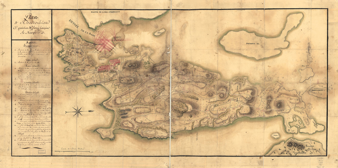
Plan of the Position of the French Army, 1780
From the collection of the Library of Congress
Picture
Picture
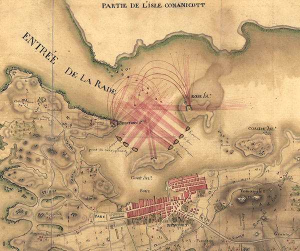
This map of Newport, dating from 1780, shows the position of French naval vessels and fortifications.
Powered by Create your own unique website with customizable templates.