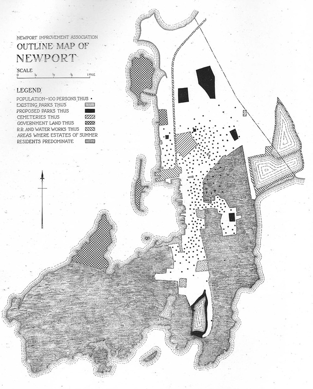
Newport, 1913
From Proposed Improvements for Newport:
A Report Prepared for the Newport Improvement Association, by Frederick Law Olmsted Jr.
From the collection of the Redwood Library and Athenaeum
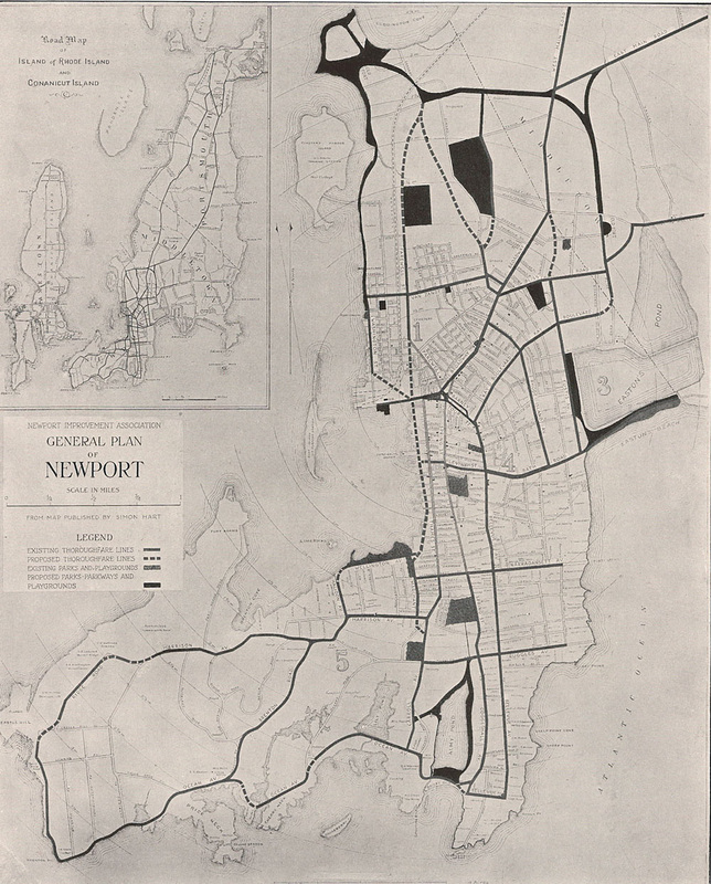
From Proposed Improvements for Newport:
A Report Prepared for the Newport Improvement Association, by Frederick Law Olmsted Jr.
From the collection of the Redwood Library and Athenaeum
|
|
In 1913, landscape architect Frederick Law
Olmsted Jr. (son of celebrated designer Frederick Law Olmsted) submitted a planning report entitled Proposed
Improvements to Newport to the Newport Improvement Association. Traveling
through the city, Olmsted observed the conditions of Newport’s streets, parks,
and neighborhoods.
He wrote: “I was impressed anew with the picturesque charm of Newport. This is certainly not a startling discovery or an original observation; but I want to make very clear that I do not say it lightly, as the usual complimentary remark. There is much that is sordid and shabby and ugly in Newport; there is much that seems vulgarly ostentatious; there is also a great deal that is charming.”
The two maps reproduced here show land use and ownership (public vs. private), existing and proposed roads, as well as existing and proposed parks.
Olmsted's entire report is available online.
