The Newport Map Project
Home
Historic Maps
1758 - Manuscript Map
1777 - Plan of Newport
1777 - Topographical Chart
1780 - Plan of the Position of the French Army
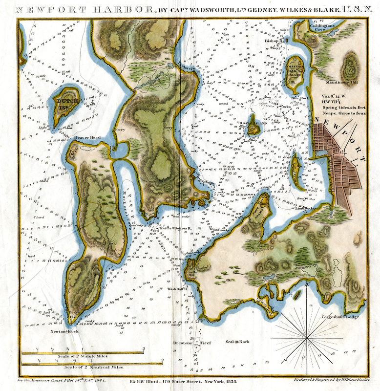
1838 - Newport Harbor
1859 - City of Newport
1876 - Atlas of Newport
1878 - Birds-Eye-View
1883 - Atlas of Newport
1884 - Sanborn Map
1893 - Atlas of Newport
1907 - Atlas of Newport
1913 - Proposed Improvements for Newport
1921 - Atlas of Newport
1933 - Newport's Famous 10 Mile Drive
1954 - A Map of Newport and Middletown
Resources
Partners
T
He
N
ewport
M
ap
P
roject
Newport Harbor, 1838
Capt. Wadsworth, Lts. Gedney, Wilkes and Blake, USN
Salve Regina University Archives and Special Collections