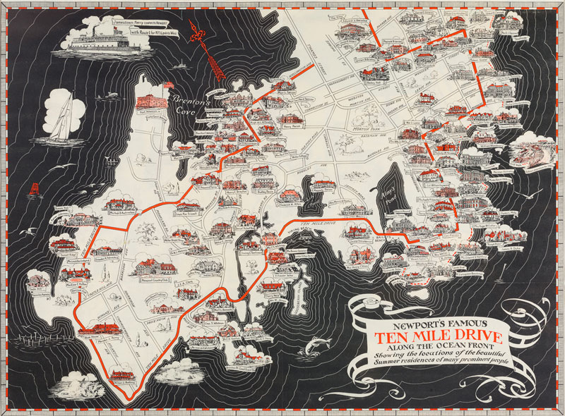
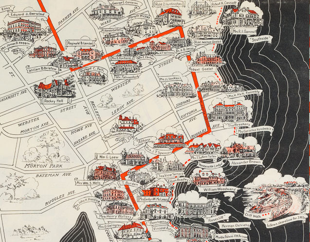
Newport’s Famous Ten Mile Drive, 1933
John W. Haley, Historian; W.H. Hetherton, Designer
Mount Hope Bridge Corporation
From the collection of The Preservation Society of Newport County
John W. Haley, Historian; W.H. Hetherton, Designer
Mount Hope Bridge Corporation
From the collection of The Preservation Society of Newport County
|
This pamphlet has several maps in it that are directly aimed at tourists. It invites the visitor to cross the Mount Hope Bridge and visit Newport, Rhode Island “on the Scenic Route to Sakonnet, Cape Cod, and New England’s Greatest Seashore Resorts.” It tries to capture an audience already on their way somewhere else to make a detour to Aquidneck Island via the Mount Hope Bridge, which connects Bristol to the north end of Aquidneck Island. There are three maps included in the pamphlet, which are all intended for visitors with a car: a map of Ocean Drive with notable houses and sites marked, the highway connections for travel in Southern New England, and a decorated map with scenes of rumrunners, mansions, and famous historical sites.
“Newport’s Famous Ten Mile Drive” guides users from the beginning of Wellington Avenue around Ocean Drive to Bellevue Avenue. This tour is of the wealth and glamour of Newport’s elite while much else is excluded, apparent in the subtitle: “Showing the locations of the beautiful residences of many prominent people.” Indeed, houses are illustrated and labeled with ribbon tags with the names of their respective owners: Auchincloss, Clark, Brown, and other major Newport families. |
